Geology history
How Michigan was built
From 3.6-billion-year-old rock in the western Upper Peninsula to the glaciers that spread stones across the state.
Ages are in millions of years ago (Ma), from the International Commission on Stratigraphy chart v2026/06.17 Tap a chapter to open it.
Two halves of the state
The western Upper Peninsula sits on very old rock from the Precambrian and Cambrian. The eastern Upper Peninsula and the whole Lower Peninsula sit on younger layered rock from the Ordovician to the Pennsylvanian.8
Most of the Upper Peninsula sits on Precambrian rock, the southern extension of the Canadian Shield. Nearly all of Michigan's metal ores, including iron, copper and silver, are found in rocks of that age.8
Michigan's bedrock map
What is under your feet, in the state map's colors
Tap a colored area on the map, or pick a rock unit from the legend, to see its name, its age group and the chapter that tells its story.
Legend: 63 bedrock units, oldest first
Archean (5)
Early Proterozoic (14)
Middle Proterozoic (7)
Cambrian (1)
Ordovician (9)
Silurian (8)
Devonian (12)
Mississippian (4)
Pennsylvanian (2)
Age not given (1)
Glaciers carried rocks away from where they formed, so beach stones may not match the bedrock under them.13 Most traveled less than about 10 miles, but some were carried hundreds of kilometers.1
Map shapes, unit names and colors: the State of Michigan Bedrock Geology map layer, saved October 21, 2026, and simplified.14 Age groups: the USGS State Geologic Map Compilation for Michigan.15 This is a learning map, not a property or access map.
1 Old crust and iron
Precambrian, about 3.6 to 1.9 billion years ago
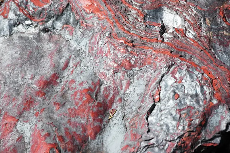
Michigan's oldest known rocks are about 3,600 million years old (3.6 billion). They come from the Watersmeet area of the Upper Peninsula.1
About 1.9 billion years ago a broad, shallow sea covered the region, and the famous banded iron formations of the Marquette and Gogebic ranges formed in it.2
The classic Lake Superior banded iron formations, including the Marquette, Gogebic, Mesabi and Gunflint iron ranges, formed in a broad, shallow sea about 1.9 billion years ago, after about 1.88 billion years ago.2 Hematite and specularite are found on the Precambrian iron ranges of the western Upper Peninsula.13
Later these rocks were squeezed, folded, broken and invaded by granite during the Penokean orogeny. Then the land wore away for about 650 million years.1
On the time scale
- 4,031 to 2,500 Ma
Archean Eon
Small continents and pieces of ocean crust were pressed together to form the Superior Province by about 2,600 million years ago. Michigan's oldest known rocks, about 3,600 million years old, are from the Watersmeet area of the Upper Peninsula.1
- 2,500 to 1,600 Ma
Paleoproterozoic Era
Mountain building called the Penokean orogeny began about 1,880 million years ago. A broad, shallow sea formed, and the Marquette and Gogebic iron formations formed in it about 1.9 billion years ago.2 From about 1,750 million years ago the bedrock sat above sea level and wore away for a very long time.1 Puddingstone's source rock, the Lorrain Formation in Ontario, is 2,200 to 2,450 million years old.3
2 The rift and the copper lava flows
Precambrian, about 1.1 billion years ago
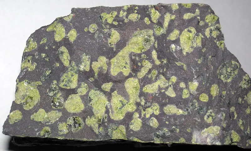
North America began to tear apart. A rift about 2,000 km long opened between about 1,109 and 1,087 million years ago and filled with lava flows. A new ocean nearly formed before the rifting stopped.4
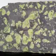
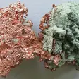
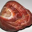
Hot fluids later left pure native copper inside the Keweenaw lava flows and conglomerates, between 1,060 and 1,047 million years ago.51 EGLE calls the Keweenaw the most important place in the world for pure native copper.13
A rift about 2,000 km long split the continent about 1,109 to 1,087 million years ago, pouring out mostly plateau basalts on land. A new ocean basin nearly formed before the rifting stopped.4
Native copper sits in lava flows full of mineral-filled gas bubbles (amygdaloidal basalts) and in conglomerates of the Portage Lake Volcanics, and formed between 1,060 and 1,047 million years ago.5 More than 5 million tons of refined copper came from Keweenaw native copper deposits from 1845 until 1968.13
On the time scale
- 1,600 to 1,000 Ma
- 1,000 to 538.8 Ma
3 Shallow seas fill a giant basin
Paleozoic, about 500 to 300 million years ago
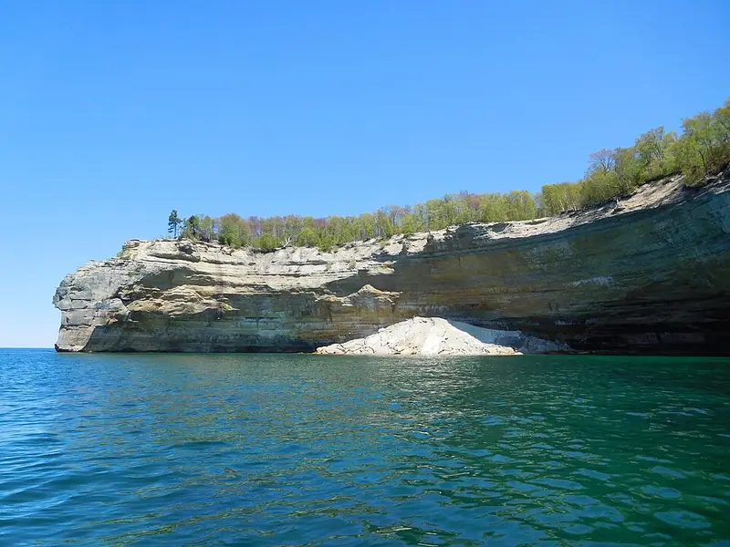
From about 500 to 300 million years ago, shallow seas came and went. They left up to 14,000 feet (4,300 m) of sandstone, shale, limestone, dolostone and salt in the Michigan Basin.1 EGLE compares the layers to a stack of shallow nested spoons.8
In the late Cambrian, sand on the shores and in those shallow seas became the sandstone of the Pictured Rocks area.1
The Michigan Basin is shaped like a stack of shallow nested spoons.8 It covers the entire Lower Peninsula and about half of the Upper Peninsula, and its rocks get younger toward the center.11
On the time scale
- 538.8 to 486.85 Ma
Cambrian Period
Seas spread over the old bedrock, and sand on the shores and shallow sea floor became the sandstones of the Pictured Rocks area.1
- 486.85 to 443.1 Ma
- 443.1 to 419.62 Ma
Silurian Period
Limestone, reef limestone, dolomite, shale and evaporites such as rock salt and rock gypsum formed.8
Michigan's salt
Silurian rock salt under the Lower Peninsula
Under the Lower Peninsula, the Silurian salt beds of the Salina Group hold about 25,000 cubic kilometers of rock salt.16
Detroit has a salt mine that has worked 317 meters (about 1,040 feet) down since it began producing salt in 1910. It is Michigan's only salt mine.16
For many years, Michigan was the leading salt-producing state in the United States.16
4 Coral reefs and the Petoskey stone
Paleozoic, 393 to 382 million years ago
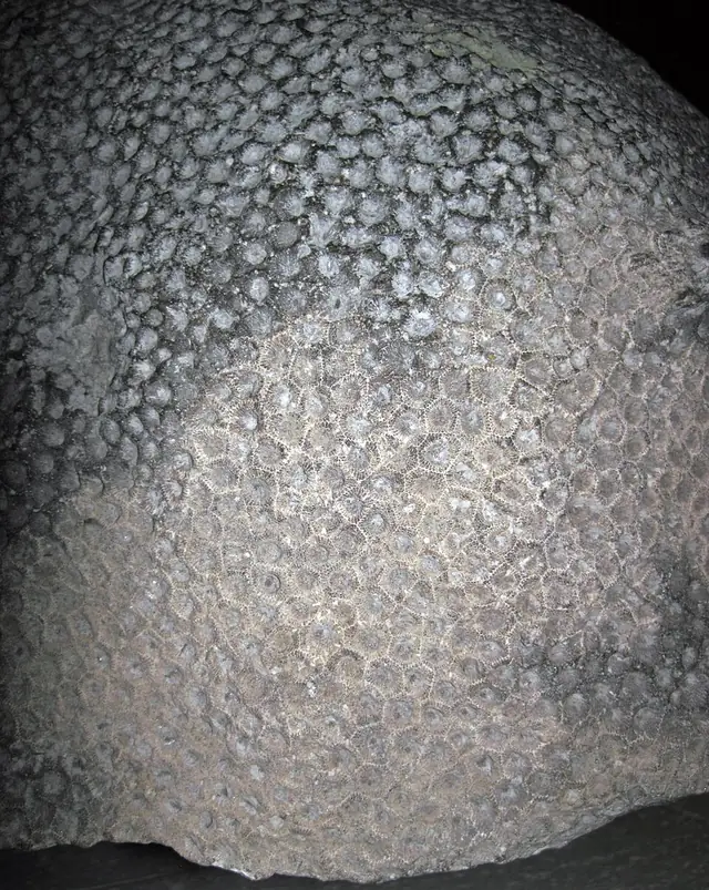
In the Devonian, Michigan sat near the equator under a shallow, tropical sea. The coral Hexagonaria built reefs there alongside other corals, brachiopods, sea lilies, trilobites, bryozoans, sponges and armor-plated fish.9
Its fossils are Petoskey stones, from the Middle Devonian, 393 to 382 million years ago.10
For millions of years, vast, shallow tropical seas covered the state, and almost all the fossils on Michigan beaches come from them. Corals are among the most common because they built huge reefs.11
On the time scale
- 419.62 to 358.86 Ma
- 358.86 to 323.4 Ma
- 323.4 to 298.9 Ma
5 Missing chapters
The Lost Interval, about 300 to 2.5 million years ago
6 Glaciers spread rocks everywhere
Ice Age, 2.58 million to about 10,000 years ago
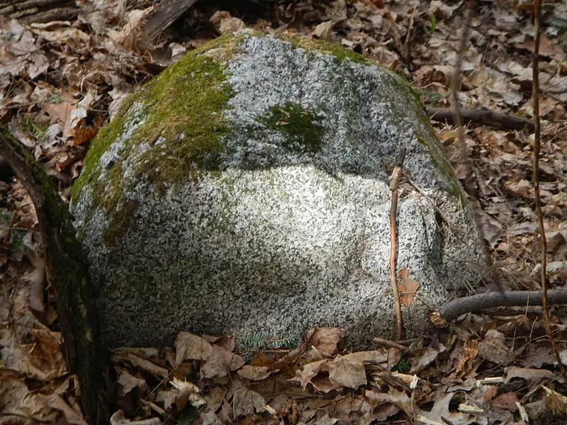
The Ice Age began 2.58 million years ago.17 Again and again, ice sheets up to one mile thick pushed down from the north and carved out the basins of the Great Lakes.1
At one point the entire state was covered by ice. Rocks that glaciers carried away from home are called glacial erratics.13
Most stones moved by glaciers traveled only a short way, typically less than about 10 miles. Some, though, were carried hundreds of kilometers.1
Rocks moved by glaciers are called glacial erratics. Puddingstone is quartzite with bright red jasper pebbles. Yooperlites are sodalite that glows under a black light, and they actually come from Canada, near Marathon, Ontario.13

On the time scale
- 2.58 to 0.0117 Ma
Pleistocene Epoch
Ice sheets up to one mile thick advanced again and again. The last one lasted from about 55,000 to 10,000 years ago and reached its farthest point about 20,000 years ago.1
7 Waves keep sorting the stones
Today, the last 10,000 years
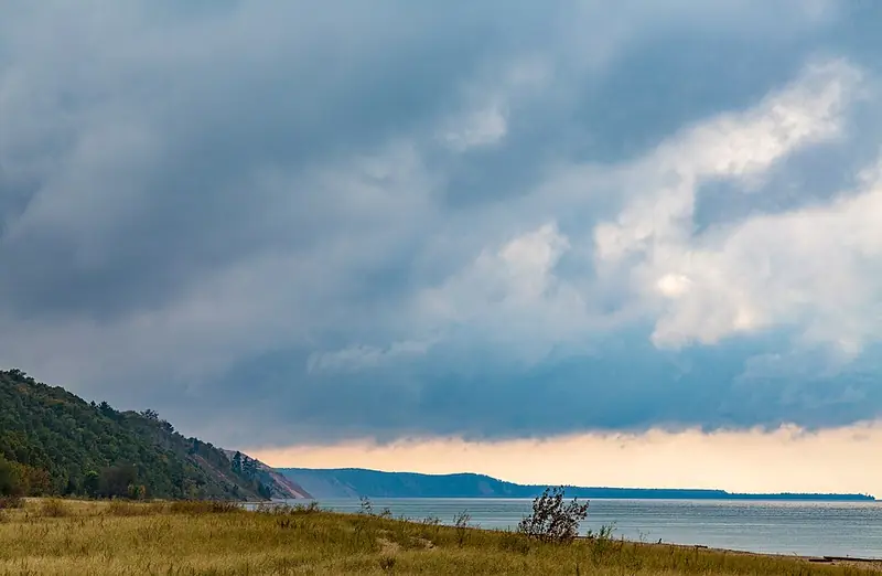
The last glaciers left the Great Lakes basin about 10,000 years ago.1
Now the waves do the sorting. EGLE suggests hunting where glacial moraines meet a Great Lake, and heading out after a storm or high waves.1311
On the time scale
- 0.0117 (11,700 years ago) to today Ma
Sources (17)
- Bornhorst, T.J., 2016, An overview of the geology of the Great Lakes basin, A. E. Seaman Mineral Museum, Michigan Technological University, Web Publication 1. https://museum.mtu.edu/sites/default/files/2019-11/AESMM_Web_Pub_1_Great_Lakes_Geology_0.pdf (checked October 21, 2026)
- U.S. Geological Survey, The Penokean orogeny in the Lake Superior region (Schulz and Cannon, 2007). https://www.usgs.gov/publications/penokean-orogeny-lake-superior-region (checked October 21, 2026)
- University of Waterloo Earth Sciences Museum, Lorrain Formation jasper conglomerate. https://uwaterloo.ca/earth-sciences-museum/peter-russell-rock-garden/1-lorrain-formation-jasper-conglomerate (checked October 21, 2026)
- U.S. Geological Survey, The Mesoproterozoic Midcontinent Rift System, Lake Superior region, USA (Ojakangas, Morey and Green, 2001). https://www.usgs.gov/publications/mesoproterozoic-midcontinent-rift-system-lake-superior-region-usa (checked October 21, 2026)
- U.S. Geological Survey, Age of native copper mineralization, Keweenaw Peninsula, Michigan. https://www.usgs.gov/publications/age-native-copper-mineralization-keweenaw-peninsula-michigan (checked October 21, 2026)
- Rose et al., Jacobsville Sandstone: a candidate for nomination for Global Heritage Stone Resource from Michigan, USA, Episodes (PDF). https://www.geo.mtu.edu/KeweenawGeoheritage/GHNEWS/ewExternalFiles/JVilleRoseetalEpisodes.pdf (checked October 21, 2026)
- Malone et al. 2018, Geosphere 14(3), reply (open copy, Illinois State University). https://ir.library.illinoisstate.edu/cgi/viewcontent.cgi?article=1032&context=fpgeo (checked October 21, 2026)
- Michigan EGLE, General Geology of Michigan (excerpt from Heinrich, The Mineralogy of Michigan, Bulletin 6, 1976) (PDF). https://www.michigan.gov/-/media/Project/Websites/egle/Documents/Programs/GRMD/Catalog/04/GIMDL-GGGM.pdf (checked October 21, 2026)
- University of Michigan Museum of Paleontology, Hexagonaria percarinatum. https://lsa.umich.edu/paleontology/resources/beyond-exhibits/hexagonaria-percarinatum.html (checked October 21, 2026)
- University of Michigan Online Repository of Fossils, Michigan backyard fossils: corals. https://umorf.ummp.lsa.umich.edu/wp/mi-backyard-fossils-corals/ (checked October 21, 2026)
- Michigan EGLE, Fossils. https://www.michigan.gov/egle/public/learn/geology/rockhounding/fossils (checked October 21, 2026)
- Michigan State University, Geography of Michigan, lecture outline 5 (PDF). https://project.geo.msu.edu/geogmich/michigan/Outlines/5.pdf (checked October 21, 2026)
- Michigan EGLE, Rockhounding. https://www.michigan.gov/egle/public/learn/geology/rockhounding (checked October 21, 2026)
- State of Michigan OpenData geology map service, Bedrock Geology layer. https://gisagocss.state.mi.us/arcgis/rest/services/OpenData/geology/MapServer (checked October 21, 2026)
- USGS, State Geologic Map Compilation (SGMC), Michigan. https://mrdata.usgs.gov/geology/state/state.php?state=MI (checked October 21, 2026)
- A.E. Seaman Mineral Museum, Mineralogy of Michigan: Halite (PDF). https://museum.mtu.edu/pdfs/HALITE.pdf (checked October 21, 2026)
- International Commission on Stratigraphy, International Chronostratigraphic Chart, v2026/06 (PDF). https://stratigraphy.org/ICSchart/ChronostratChart2026-06.pdf (checked October 21, 2026)